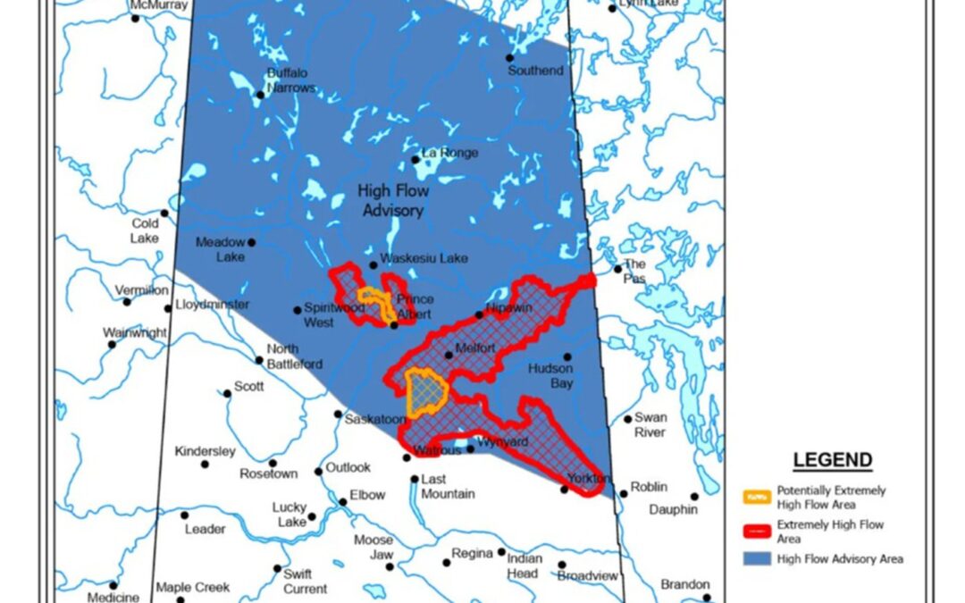
Photo: High flow areas as of May 8, 2026.
By: Nicole Goldsworthy
Local Journalism Initiative Reporter
SaskToday.ca
Officials in the Northern Village of Lac Île à la Crosse are monitoring rising water levels as provincial forecasters warn additional rainfall and runoff could worsen conditions across northern Saskatchewan in the coming weeks.
The village shared an update on social media from a hydrologist with the Saskatchewan Water Security Agency (WSA), outlining current conditions and projected lake levels for Lac Île à la Crosse.
According to the update, the lake level was estimated at about 419.30 metres as of May 13, roughly seven centimetres higher than levels recorded on May 10.
Hydrologists said this year’s inflow is tracking near what would typically be considered a one-in-10-year event based on river flows, watershed conditions and historical comparisons.
“If current conditions continue, forecast the lake could peak between 420.7 and 420.9 metres in the coming weeks or months — an increase of about 1.4 to 1.6 metres above current levels. The forecast noted above-normal summer precipitation could further affect lake levels,” the Northern Village of Lac Île à la Crosse said.
Lac Île à la Crosse generally rises gradually toward seasonal peaks and cautioned the forecast is based on limited historical data and should be considered alongside local observations and community knowledge, the Northern Village of Lac Île à la Crosse said in a post.
The update comes as the WSA warns a significant rainfall event on May 14 is expected across much of Saskatchewan, which could create additional flooding concerns, particularly in northern regions already experiencing above-normal runoff.
In its May 13 spring runoff report, the agency said 15 to 30 millimetres of precipitation is forecast for parts of northwestern Saskatchewan, including the Meadow Lake area, with localized areas potentially receiving higher amounts. Rainfall may also transition to snow later in the week.
The WSA said the additional precipitation could increase river flows and accelerate snowmelt in northern areas where snow remains. Saturated ground conditions and high soil moisture levels are limiting the landscape’s ability to absorb more water, increasing the risk of rapid runoff.
While lake levels are not expected to rise significantly during the rainfall event itself, WSA warned levels may increase afterward as runoff drains into lakes and waterways.
The agency also warned strong winds forecast across the province could create significant wave action, increasing the risk of shoreline erosion and localized flooding in vulnerable lakeside areas. Ice movement remains a concern in northern regions where ice cover persists.
Residents are being encouraged to stay informed about local conditions and use caution near waterways and low-lying areas.
The WSA said it continues to work closely with affected communities and has made more than 1,200 proactive contacts through emails and phone calls with municipalities and local officials in areas experiencing extremely high flows.