Photo: Highway 165 southwest of Beauval has been closed between Beauval and the junction with Highway 155 due to significant flood damage. / Courtesy of Beauval EOC
By Nicole Goldsworthy
Local Journalism Initiative Reporter
SaskToday
Widespread flooding across northeast Saskatchewan has led to numerous highway and rural municipal road closures, as the Saskatchewan Public Safety Agency warned of heavier than normal spring runoffs.
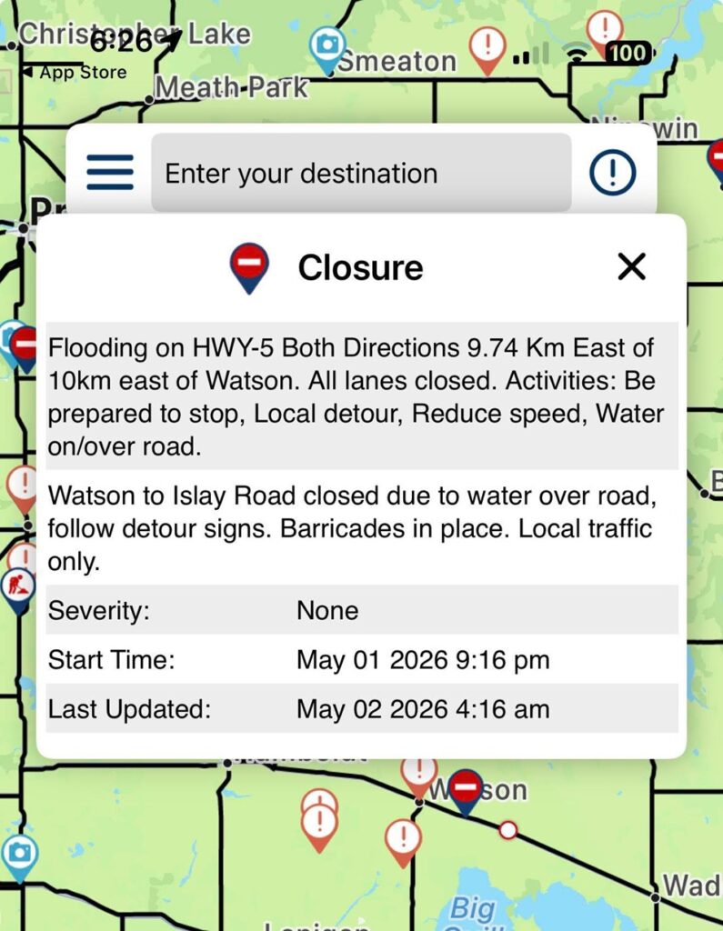
On May 1, several communities and rural municipalities had posted of road closures due to flooding. The Town of Wakaw reported water flowing over Highway 2 just north of the community, as well as over the Regional Park Road.
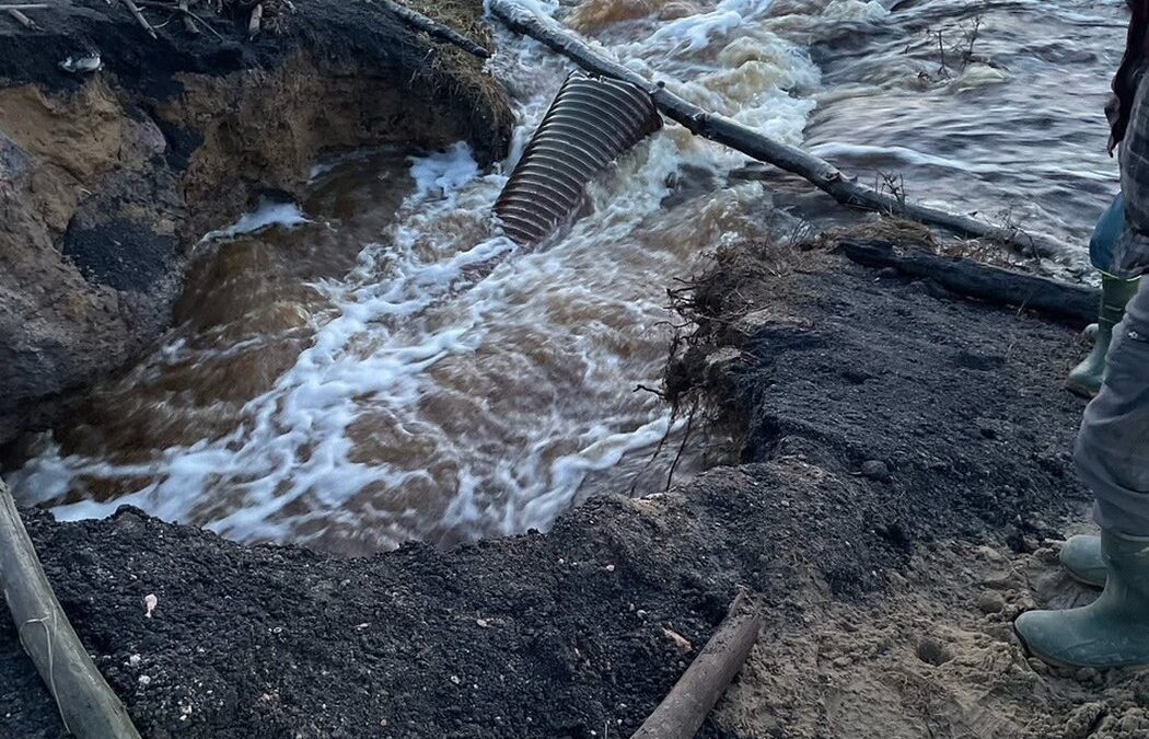
Further north, Highway 165 southwest of Beauval has been closed between Beauval and the junction with Highway 155 due to significant flood damage. The Beauval EOC said on Facebook a washed-out culvert and fast-moving water are eroding the road beneath the asphalt, making it unsafe for travel.
Security checkpoints and barricades have been with local fire crews monitoring access. Authorities emphasized that no vehicles are permitted, noting that traffic over the damaged section is causing further deterioration.
In the RM of Arborfield, Warners Bridge and the Jordan River Bridge remain closed due to high water levels. The RM said on social media that many additional roads have water flowing over them and may not be marked, urging drivers to proceed with extreme caution.
The RM of Pleasantdale has also issued an extensive list of closures, including:
- Range Road (RR) 2172 from north of Highway 349 to Township Road 412
- RR2174 between Township Roads 410 and 412
- RR2180 between Township Roads 424.3 and 430
- RR2173 between Township Roads 400 and 402
- RR2161 between Township Roads 424 and 430
- RR2181 between Township Roads 410 and 410.5
- Township Road between RR 2183.6 and 2185
- RR2182 between Township Roads 422 and 424
- RR2181 between Township Roads 422.5 and 424
- Township Road 415 between RR2182.4 and RR2183
- RR2182 between Township Roads 412 and 413
- RR2163 between Township Roads 404 and 411.7
The RM of Pleasantdale said that detours are in place where possible.
Additional closures have been reported in surrounding municipalities. In the RM of Hudson Bay, flooding has closed Range Road 2042 south to Township Road 450, including a section of Township Road 450 between Range Roads 2042 and 2043.
The R.M. of Lakeside No. 338 reports several closures, including:
- Township Road 361 between the 640 grid and Range Road 2162
- Range Road 2162 from Highway 5 to Lakeview Road
- Range Road 2181 from Highway 5 to Township Road 370
- Range Road 2185 north of Highway 5
- Range Road 2183 between Township Roads 362 and 350
The R.M. of Garden River No. 490 reported that a road between Township Road 504 and the Whitestar Grid has been closed due to flooding.
According to the Water Security Agency, rising temperatures are accelerating snow melt, leading to increased stream flows across central and northern Saskatchewan. Affected areas include the Carrot River, Red Deer River and Quill Lakes basins, where water levels are rising.
Forecasters indicate that continued above-zero overnight temperatures will sustain runoff, though remaining snowpack will influence how quickly conditions evolve in the coming days.
Drivers are urged to avoid flooded roads, obey all closures, and monitor local advisories as conditions continue to change.
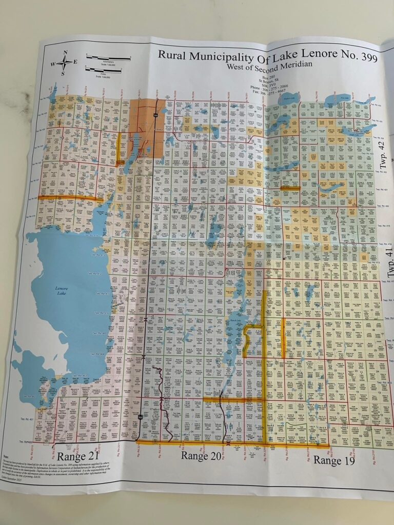
Updated Map as of 8:05 am May 2 for the RM of Lake Lenore road closures.
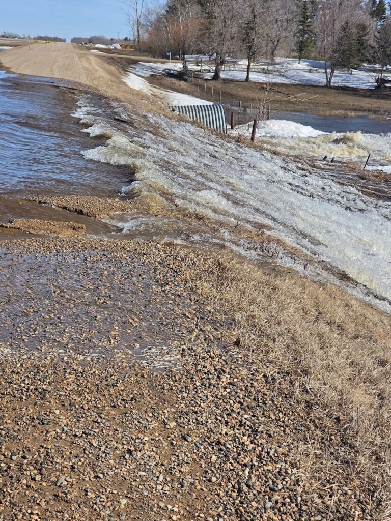
RM of Lakeside posted five road closures on May 1.
Flooding over highway 5.