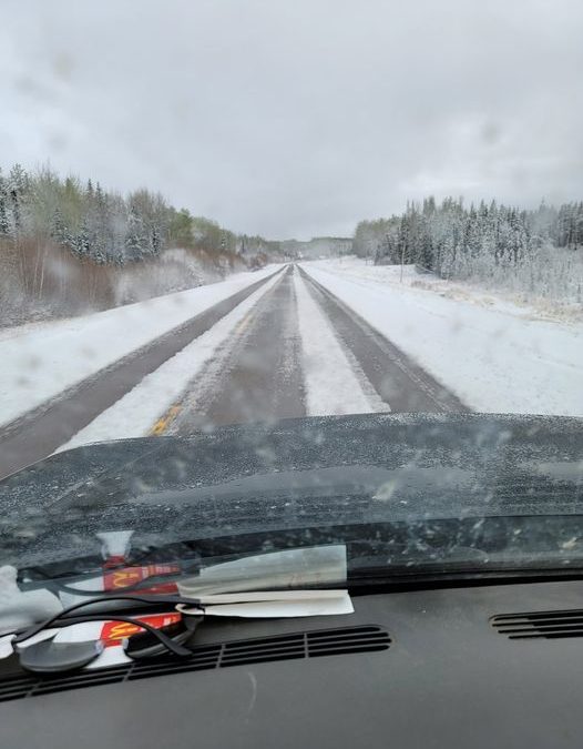
Northern Saskatchewan was hit with cooler temperatures on Wednesday.
Terri Lang, a meteorologist with Environment and Climate Change Canada, said a big weather system went through the province over the last 24-hours, causing the cool-down.
According to Lang, this brought snow and rain into the north on Tuesday and left southern Saskatchewan with “record-breaking” high temperatures.
However, she said a cold front has now moved across the entirety of the province.
“There’s a lot of flurry activity and low cloud floating around but that will slowly clear out,” she said. “We have a big ridge of arctic high pressure that’s going to settle over northern Saskatchewan and it’s going to bring some really cool, unseasonal temperatures to the north and central parts of the province.”
This is all happening as firefighting teams battle a wildfire northeast of Prince Albert where Lang said the cooler temperatures are likely appreciated.
“When the temperatures cool down, the humidity tends to come up and it slows the aggressive behaviour of the fires, so it should help the firefighters get a handle on things. Unfortunately, there wasn’t a lot of precipitation that came with the system in central Saskatchewan.”
However, she said there should be some humidity coming to this part of the province in coming days.
“We’re keeping our fingers crossed that for maybe Monday that they may get some moisture.”
The current weather conditions are set to continue into the Victoria Day long weekend.
Lang said residents should be prepared if they plan to spend the long weekend outside.
Snow is in the forecast for southwestern Saskatchewan while the rest of the province will likely be seeing cooler temperatures.
(PHOTO: Weather conditions took a turn for the worse in northern Saskatchewan on Wednesday. Photo courtesy Lucas Welsh Facebook page.)